
Keyline Design for Graziers: Scale of Permanence, Keypoints, Keyline Plowing and Water Harvesting Dams
A sourced guide to P.A. Yeomans' keyline design: the Scale of Permanence, keypoints and keylines, keyline plowing, keypoint dams and how graziers use it today.
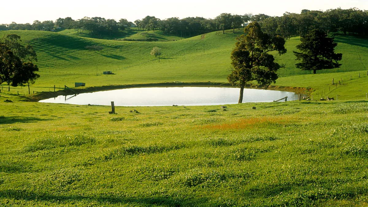

Keyline design is a way of reading a landscape's shape and then laying out water, roads, trees, fences and soil work so that rain stays on the land longer. Australian farmer P.A. Yeomans developed it in the 1940s and 1950s. Seventy years later, graziers still use its ideas on everything from Australian sheep country to New Mexico rangeland. This guide covers the core pieces: the Keyline Scale of Permanence, keypoints and keylines, keyline cultivation with a subsoil plow, keypoint dams, and what the modern evidence says.
Two free primary sources, both in the Regrarian Resource Water & keyline library, sit behind most of what follows:
- The Keyline Plan by P.A. Yeomans (1954), his first book (free PDF from the Soil and Health Library)
- Keyline Design Mark IV by Abe Collins and Darren J. Doherty, a seminar-based update that covers keypoints, keyline dams, cultivation pattern, roads, trees and fences
Where keyline came from
The biography printed with The Keyline Plan says Percival Alfred Yeomans was born in Harden, New South Wales, in 1905 and died in November 1984 at age 79. (The Mark IV article gives his birth year as 1904.) Collins and Doherty write that Yeomans began keyline as a practical response to unpredictable rainfall on his property "Nevallan," west of Sydney. After his brother-in-law died in a grass fire on Nevallan in 1944, he set out to store enough rainwater in farm dams to keep the land green, and in his words "virtually fireproof." Yeomans had worked as a mining overseer and earthmover, and he drew on that experience. The U.S. Fish & Wildlife Service dates the start of keyline design to 1945 (USFWS case study).
Yeomans later designed cultivation equipment. The Keyline Plan's biography credits him with the first rigid-shanked vibrating subsoil ripper for farm tractors, the Bunyip Slipper Imp. It won the Prince Philip Design Award in 1974 and was developed into today's Yeomans Keyline Plow by his son Allan's company.
1. The Keyline Scale of Permanence
The most widely borrowed idea from keyline isn't a plow line. It's a planning order. Yeomans ranked a farm's features from hardest to change to easiest, and argued that design should follow that order. According to Collins and Doherty, Yeomans called climate, land shape and water supply the "inseparable trinity of landscape design," with the rest being the "more negotiable remainder of the hierarchy."
The Mark IV article lists the scale as:
- Climate
- Land shape (topography and underlying geology)
- Water
- Roads
- Trees
- Buildings
- Subdivision (fences; the Yeomans family's Keyline Designs site lists this step simply as "Fencing")
- Soil
Two features of the list surprise first-time readers.
- Soil comes last. That isn't because soil matters least. It's because Yeomans thought soil was the fastest thing a manager could change. The dedication in The Keyline Plan is "to The Fertile Soil," and Collins and Doherty quote him saying the landman's job "is not so much to conserve soil as it is to develop soil."
- Fences come after water, roads and trees. For a grazier, this is the practical heart of the scale. Paddock lines drawn before the water plan is done tend to cut across natural flow lines and leave water points in the wrong places. Doherty's Mark IV rule of thumb is to build fences along creeks, drainage lines and main ridge crests, to fence off dams and open water from stock, to protect shelterbelts and tree lines, and to use lightweight electric fencing for internal paddocks.
Darren Doherty's ten-layer Regrarians Platform extends this order for modern farm planning. Regrarian Resource's guide Map Your Ranch with the Regrarians 10 Layers walks through it step by step.
2. Reading land shape: ridges, valleys, keypoints and keylines
Keyline design starts with a contour map. Collins and Doherty describe three water lines and three land shapes:
- Water lines: the contour (a level line, like the edge of a lake), the water drainage line (the center of a stream or gully) and the water divide line (a ridge crest)
- Land shapes: the main ridge, the primary valley that erodes into its side, and the primary ridge between primary valleys. The Mark IV article notes there is always one more primary ridge than primary valleys in a main-ridge system.
The keypoint
In The Keyline Plan, Yeomans defines the keypoint by a change in how a valley relates to the ridges on either side of it:
- Above the keypoint, the valley floor is narrower and steeper than the adjacent ridges.
- Below the keypoint, the valley floor is wider and flatter than the adjacent ridges.
On a contour map, Collins and Doherty explain, the keypoint shows up where contour lines in the valley center are close together above and spread apart below. That is the point where the valley floor suddenly flattens. Yeomans' simplest example (his Map 1) is a valley where contour lines stay evenly spaced down to the 180-foot line and then spread out sharply. That 180-foot contour is the keyline.
The keyline
The keyline is the contour line, or a gently sloping line, carried in both directions from the keypoint across the valley shape (The Keyline Plan). Two practical notes from the Mark IV article:
- Keylines usually do not join up from one valley to the next. Keypoints of neighboring primary valleys generally have a rising or falling relationship, because main ridges slope.
- Yeomans wrote that any property that includes a watershed or water divide has one or more keylines.
Finding the keypoint takes a decent contour map. Collins and Doherty point out that government maps often have 10–20 m (roughly 33–66 ft) contour intervals, too coarse for farm design. Surveyed maps can resolve intervals as fine as 100 mm in flat country or 1–2 m on hills. Yeomans himself described farm contour maps at vertical intervals from 25 feet down to 2 feet. Today, ranchers often build their own detailed elevation maps from drone photos, as the New Mexico case study below shows.
3. Keyline cultivation and the subsoil plow
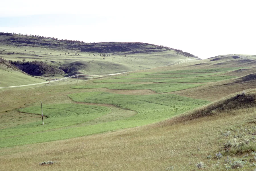

Water flows at right angles to the contour. On undulating ground, that means it concentrates in valleys while the ridges stay dry. Plowing exactly on contour would seem to fix this, but Collins and Doherty explain why it doesn't: valleys and ridges have different shapes, so contour-parallel lines drift off contour as they cross from one shape to the other.
Keyline pattern cultivation works with that drift on purpose. Mark IV summarizes the rules:
- In primary valleys, cultivate parallel to the keyline, above and below it.
- On primary ridges, cultivate parallel to and upward from a contour guideline.
- Lower in valleys, cultivate parallel to and below a contour guideline.
The result is a set of rip lines that run very slightly downhill from the valley center out onto the ridge. In the Mark IV article's words, this pattern "causes water to drift away from valley centres and toward ridge crests, where it is held until it soaks in." The authors warn that if the basic rules are broken, "water will flow the wrong way, concentrating in the wrong places."
How deep, and with what
The Keyline Plan gives Yeomans' own numbers for the "conversion year," the first year of soil-building cultivation:
- He recommended a general depth guide of about double the previous plowing depth, roughly 8 inches, or 7 inches in poorer soils. He also warned that deep cultivation of sticky clay subsoil is "waste of time and money" because it seals as soon as rain falls.
- He said moldboard and disc plows could not follow keyline lines well and produced a destructive "even-bottom" cultivation.
- His preferred tool at the time was a chisel-type plow with 2-inch tines at 12-inch spacing. The first working was 3 to 4½ inches deep, followed by deeper runs, with usually three fast passes needed on poor, compacted soils.
The modern descendant is the Yeomans Keyline Plow. The USFWS case study describes its design: a thin shank that reaches depth with little surface disturbance, and a wide boot at the bottom of each shank that "fractures and aerates subsoil." The Regrarian Resource library links to Yeomans Plow Co. with no affiliate relationship.
The grazing connection. Collins and Doherty describe planned grazing and keyline soil-building as going "hand in hand." The grazing plan schedules both tools, animal impact and the subsoil plow. They call grazing animals "biological accelerators" of mineral cycling.
4. Water harvesting: keypoint dams and diversions
Water is third on the Scale of Permanence and the backbone of a keyline plan. Collins and Doherty describe the system this way: runoff is stored in dams, then later released for gravity-powered irrigation, and roads, trees, buildings and fences follow the water layout.
Where the dams go
According to the Mark IV article:
- The highest storage dam site in a primary valley is just below the keypoint. This is the keypoint dam, and the keyline becomes its top water level.
- Good valley dam sites have a flatter valley floor (more water backed up per foot of wall), a short wall, a wide valley behind the wall, a suitable spillway location, soils that hold water and a sound foundation.
- Other keyline dam types include saddle dams, contour or ridge dams, ring dams and turkey nests.
- Keyline dams traditionally carry a large pipe with baffle plates and a valve through the bottom of the wall (Yeomans' "lockpipe") for irrigation and control.
Linking dams with diversions
Dams are tied together with diversion channels. The Mark IV article gives a fall of about 1:400 for diversions that carry runoff into a dam. Irrigation channels dug into hillsides need a fall of at least 1:300. Because keypoints in neighboring valleys usually step up or down, a diversion from one dam can feed the keyline of the next. When the diversion falls more gently than the creek below it, an increasingly large area between the channel and the creek can be irrigated by gravity.
Collins and Doherty also make a point graziers appreciate: stored water is a "second savings account." A full dam beside dry, unused paddocks in a drought is a sign of failure, not success.
A caution for US ranchers. Dam building, water diversion and stored water rights are regulated by states and counties, and dam safety rules apply above certain sizes. Earthwork of this kind needs local engineering and water-rights advice before any dirt moves. NRCS conservation planners and local Resource Conservation Districts are a free place to start (see Regrarian Resource's EQIP guide).
5. How graziers apply keyline today
Most modern ranchers don't build Yeomans' full system of interlinked dams and flood irrigation. More often, they borrow three pieces:
- The planning order. Many graziers use the Scale of Permanence, or Doherty's Regrarians layers, to decide where water points, lanes and permanent fences go before they buy a single post.
- Keyline subsoiling of pasture. They rip lines on the keyline pattern to break compaction and spread water toward ridges, often seeding in the same pass.
- Contour-aware fencing and lanes. Laneways and permanent fences follow ridges and water lines, and temporary electric fence does the fine subdivision.
A rangeland example: northern New Mexico
The USFWS Conservation and Adaptation Resources Toolbox documents two ranches, C-B Ranch and Esquibel Ranch, using keyline design with New Mexico Healthy Soils Program funding (USFWS case study). Key details:
- In high-intensity rain, as much as 80% of the rain on C-B Ranch ran off its 3% slope instead of soaking in.
- Managers mapped the land with a consumer drone and GIS software, then laid out lines with a rented laser level.
- Swales and rip lines were spaced 100 feet apart, set slightly off contour to steer water toward drier areas. Rip lines were 15 inches deep, cut with a two-shank Yeomans plow that also dispensed compost tea and cover crop seed.
- Seeded cover crops grew in the rip lines in the first year. The case study says measurable vegetation and soil organic matter gains in that dry climate take at least five years of ongoing management.
- The estimated project cost was $10,000. The ranchers cut costs by sharing tractors, plows and mapping tools.
What the research says
The evidence base is growing but still thin, and results depend on soil and climate:
- Vermont, rotationally grazed clay pastures (2025): A three-year trial at two farms compared keyline plowing with pasture-cropping mixes for compaction. At one farm, keyline plowing gave the lowest median penetration resistance but varied more between replicates. A sudangrass-based cover mix gave the most uniform improvement overall (Utemuratov et al., Agricultural & Environmental Letters).
- Semi-arid central Chile: A trial on three farms reported that keyline management increased compressed forage height by 44% and yield by 25% compared with controls, with results varying by location (International Grassland Congress paper).
- Rangeland trial by researchers in Durango, Mexico (2025): Plant cover reached 42% where keyline channels were combined with Yeomans plowing and 34% with keyline channels alone, compared with 5% on the untreated control. The control also lost more soil to erosion (Biotecnia).
- Ontario, on-farm trial (2016): The Rural Agri-Innovation Network found no clear soil moisture trend from keyline subsoiling and concluded the site had no compaction problem to fix (RAIN results).
The practical reading is that keyline subsoiling helps most where compaction or runoff is the real problem. Where it isn't, the plow may add little. Regrarian Resource's guide How to Judge a New Ranch Gadget's Evidence suggests running a trial paddock before treating a whole ranch.
Getting started: a keyline checklist for graziers
- ☐ Get the best contour data available. Coarse government contours aren't enough for farm design, so consider a drone survey or a surveyed map.
- ☐ Mark main ridges, primary valleys, primary ridges and drainage lines.
- ☐ Find each primary valley's keypoint (where the valley floor flattens) and draw its keyline.
- ☐ Plan in Scale of Permanence order: water, then roads and lanes, then trees, buildings and fences, then soil work.
- ☐ Before any dam or diversion, talk to NRCS, the local RCD and a water-rights advisor.
- ☐ Trial keyline subsoiling on one paddock first. Plow when the soil is neither bone-dry nor muddy, and compare it against an untreated strip.
- ☐ Fit the grazing plan around the design, using it to schedule animal impact and recovery (Your First Grazing Plan in One Afternoon).
Go deeper
- The Keyline Plan (P.A. Yeomans, 1954, free PDF)
- Keyline Design Mark IV (Abe Collins and Darren J. Doherty)
- Water for Every Farm, Yeomans Keyline Plan (compiled by Ken Yeomans from P.A. Yeomans' writings), on the Yeomans family's Keyline Designs site, which also restates the Scale of Permanence
- The Challenge of Landscape (P.A. Yeomans, 1958), free from the Soil and Health Library with permission of Allan Yeomans
- Keyline Designs, the Yeomans family's site
- Films of P.A. Yeomans building a keyline dam, and Darren Doherty planning a farm, on the Regrarian Resource Videos page
- Keyline, swales and Scales of Permanence in context on the Permaculture page
Sources
- Yeomans, P.A. The Keyline Plan. Sydney, 1954 (Soil and Health Library PDF, including biography).
- Collins, A. and Doherty, D.J. Keyline Design Mark IV (hosted by the California Ag Water Stewardship Initiative).
- Alessi, J.R. (2024). "Restoring Rangelands in Northern New Mexico with Keyline Design." CART, U.S. Fish & Wildlife Service.
- Utemuratov et al. (2025). "Pasture cropping and keyline plow as strategies to mitigate compaction in clay soils in Vermont." Agricultural & Environmental Letters.
- "Effect of the hydrological keyline design on the growth and quality of the naturalized grassland in the dry central zone of Chile." International Grassland Congress Proceedings.
- "Hydrological keyline design in a grassland: impact on vegetation and soil." Biotecnia 27.
- Rural Agri-Innovation Network, "Keyline trial results 2016."
Facts checked November 11, 2026.
Free: Grant Starter Kit
Checklists and templates for EQIP, SARE and Zero Foodprint applications.